Header Graphic
Coon Lake Improvement District
Coon Lake History

Geological and Geographical History of the Coon Lake Area

The processes that have shaped the area of Coon Lake started about 12,500 years ago during the ending of the last glacial ice age.  There has been 21 glacial ice ages.  We are interested in the last one because it gives us clear evidence of the sediment record for our area. 

About 12,500 years ago glacial Lake Grantsburg formed just north of the Coon Lake Area and covered a very large area ending near Isanti County.  This lake lasted only about 100 years before draining down.

About 10,000 to 12,000 years ago the melt water from the glaciers melted more as warming continued and formed  glacial Lake Anoka. This glacial lake was vast and covered all of Anoka County.   This area was low from a depression in the rockbed formed millions of years ago. Generally a shallow lake, glacial Lake Anoka filled in with fine sands carried by the glacial melt water.

Two glaciers, one named Grantsburg and the other Des Moines contained the melt water.  They had come together over the Coon Lake area over time.  One from the northwest (Des Moines) and one from the northeast (Grantsburg).

About 10,000 years ago glacial Lake Anoka began to drain when ice covered land in Chisago County collapsed.  Glacial Lake Anoka slowly drained until our present day was exposed.  Most of the lakes and bogs in our area came from huge chunks of ice that had broken off from the glacier and did not melt  because they were buried by sediment.  After they melted there were depressions left in the landscape which filled with water leaving us the lakes, swamps and bogs.

The unique feature of these glaciers is that they carved out a large melt water valley at the base of their lobes. These are geologically known as Tunnel Valleys.  These Tunnel Valleys held more and bigger ice blocks which lead to a linear depression, today of which is a chain of lakes.  Our present day chain of lakes in our area is Typo, Martin, Linwood, Fish,Boot,  Rice, Beet, Island,  Coon, Little Coon, South Coon,  Netta, and Ham lakes.  All of the surrounding bogs and swamps are a result of buried ice chunks.  Coon Creek Could be the remains of the tunnel stream from melting glacial water to the Mississippi River. The southern side of this Tunnel Valley Includes the Lakes in the Centerville Area just south of Coon Lake. 

The result of all this is a great out wash plain that covers the Coon Lake area (Much of Anoka County).  It is unique , being built entirely of sediment from far distances. This unique feature is known as the Anoka Sand plain.  From the county in which is most featured. The sediment is composed mostly of sand and very fine sand.


The post glacial period leaves behind the geological features of what the area is like today.  How ever isolated features had yet to be developed.  Peat accumulation began and continues to this day in swamps and bogs.  The receding ice sheets and the changing water table allowed the favorable conditions for plant invasion in the area.  There were many small shallow lakes in the area that became colonized by the peat forming species and these areas became our present day bogs.  From these bogs we can take a pollen analysis which shows an accurate record of the plant species that have come and gone since the last ice age.  This is possible because lakes and bogs have sediment record from the time of inception.  Pollen  is best preserved in this anoxic environment.

One of these studies includes the Coon Lake Bog. Located in section 36 of Anoka County.  This area lies on the south east side of Coon Lake   Another bog studied is the Coon Creek Bog which is just south of Coon Lake in section 26.

These areas where first studied in 1935 and 1937.  At that time the Coon Lake bog consisted of mainly tamarack (much of the area was known as an impassable bog known as tamarack swamp) black spruce, labrador tea, and red osier dogwood.   The surface of the bog was a course, fibrous, and woody peat layer made up of branches and roots from trees and shrubs.  The Coon Creek bog consisted of mainly tamarack, white pine and paper birch.  So as you can see in a short distance a variety of dominate plants and trees existed.

The pollen record begins with an overwhelming dominance of spruce-fir forest in the area in which 90% of the pollen is at the lowest level of the bogs.  Pollen from asters, daisys, sunflowers, grasses, pigweeds and flowering plants are found through out the bog profile.

This dominance of spruce-fir held for a brief period of time and practically disappear from the record and pine and oak succeeded to be the dominate species.  A general increase in grass pollens suggests a warming period, or major climatic change in the middle of the profile.

The spruce began to disappear about 9,000 years ago, and was replaced by pine forests and some small amounts of black ash, paper birch and elm.  About 8,000 years ago the climate warmed and the pine declined and prairie grasses began to increase. Oak trees became more widespread at this time.

The climate continued to warm and about 7000 years ago the prairie had reached its most north and east levels about 4,500 years ago,which is about 75 miles north of Coon Lake.  The area would of looked similar to that of how the western Dakotas look today.  This is also known as the "Prairie Period" for it was to warm for trees to survive.

About 4,000 years ago the climate began to become more moist and cooler and the oak woodland became the dominate.  White pine soon followed and the prairie border was moved more westward as the cooling period continued. This cooling continued to about 500 years ago and we are left with the pre Euro-American settlement era. This era was dominated by frequent fires, which kept oaks in their grove.

Along with scientific studies and journals of early explorers we get much of the early data from our own governments work from 1847-1857 in which the General Land office of the US Government collected samples of vegetation when surveying the area.  Shortly after this time there was a dramatic increase in the amount of Ragweed pollen found in sediment of that time. Ragweed thrives on disturbed soil which was created in abundance by plowing up the fields and or cutting up the forests.  The increase is so dramatic that it is used as chronological marker for European settlement.

The landscape at the time of settlement was dominated by scrubby oak woodlands, marshes and swamps were extensive in the Coon Lake area, but prairie and forest was just a few miles west.  The area was known as an impassable bog and was accessible only when frozen. The diversity of habitats includes the following. White pine hardwood forest, mesic oak forest,  mixed hardwood swamps, alder swamps, rich fen, wet meadow, tamarack swamp, ferns, blue beaded lily's, ground pine, ground cedar, blue berry and huckleberry, winter berry bushes, mixed emergent marsh.

By 1913 about 21% of the wetlands in Anoka County had been drained leading to much of the agriculture activity of the last 150 years.  How all of this has changed the local hydrology is unclear.  We do know that the landscape alteration and introduction of carp have decreased the plant diversity, and aquatic areas now suffer from increased nutrient runoff which leads to increased algae and aquatic weed production choking the waters.

Very few settlers came or lived in the area in 1850, yet by 1875 most of Anoka County had been declared cleared of woodland and made into farmland.  By 1940 70% of the region the was considered farmland.


Cultural history around the immediate area of Coon Lake  has its own history and begins at the last ice age.  People entered the area at the end of the last ice about 10,000 years ago.  The climate in which they traveled and lived  8,000 years ago was a rapidly warming to about 7,000 years ago. 6,000 years ago there was period of cold winters that lasted until about 3,000 years ago. At this time we have one of the warmest post glacial summer periods lasting until A.D. 950.  About this time we begin a 2000 year cooling trend in North America with a little ice age occurring between 1550 to 1900s.   In 1915 the climate was considered cool to mild in the area.  Our present day climate is classified as maximum warmth.

The life of these early peoples in the area had to adjust to these rapidly changing landscapes.

The first inhabitants were most likely Paleoindians.  Their archaeological sites are difficult to find since they are small, and buried deep.  They were highly mobile gathers and hunters and pursued game such as bison, caribou, mastodon, and mammoth.

Archaic hunters and gathers were next to visit the region.  This was about 8,000 years ago. These inhabitants specialized in smaller game, fish, shellfish, plant foods and other natural energy sources.

In our most recent era woodland peoples inhabited the area from A.D. 500 to 1650.

The first Europeans to set foot in Minnesota were two French men, Sieur des Groseilliers and Sieur de Radisson in about 1660.  They exploited the area for their own market system, and traded with the Native Americans in Minnesota.  The contact period of Native Americans with the European explorers took place in the late 1600s.

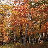
Our western region at the time had many environmental characteristics which includes woodlands dominated by oak, deer, bear, beaver, moose and a principle wild rice area, some bison were present  and corn could be grown. Acorns were an abundant food source.  Bow and arrow was used.  The ability to store wild rice from season to season and the incorporation of agriculture lead to more of a sedentary lifestyle.  More is known about this culture because of the preponderance of sites found at the NE corners of lakes and wetlands, which are naturally protected from fire due to prevailing winds during the fire season. 

At contact in the 1660s Santee Dakota groups controlled the east part of the central lakes region and other Dakota groups controlled the the western part.  In the late 1700s the Ojibwa began to move into the area and controlled this section of the central lakes. Much area to the south at this time remain unoccupied. The first contact period ends with the building of Fort Snelling in 1821.

In about 1890 there was a last report of a bison in the area of Carlos Avery.

Coon Lake named for the Raccoons in the area is located in Anoka county which gets its name  from the Sioux word meaning "the other side" or "both sides".

The townships and villages that sprung up around the lake consist of  Bethel which was first settled in 1856 by Quakers and its name meaning is "House of God". Bethel was a highland, prairie, woods, swampland and lowlands of peat.  Columbus was settled in 1855 and was named for Christopher Columbus. Columbus was also known for its lowland grasses which were used to make rugs in the 1880s.  Most of the area is now known as Carlos Avery.  Ham Lake was settled in 1857 and had a name of glengarry, which the commissioners changed to Ham Lake for the lake in its territory, of course shaped like a ham. This area was more suitable to farming. The lake was known for its sandy beaches.

A typical farming operation at the time consisted of dairy, wheat, oats, corn, barley, potatoes hay, apples, tobacco, wool, butter and honey.

A grass hopper plague entered the area between 1873 and 1877.

In the 1880s Passenger Pigeons blackened the sky for hours.  These were considered "a delicious table bird' which ultimately lead to their extinction.

Telephone service was established in 1903 and was $6.00 per year.

Some of the lakes in the area get their names from their features, boot lake from its boot outline, island lake from its island, rice lake for its wild rice.

Old settlement villages on Coon Lake Include Breezy Shore Village in Columbus township section 30 in 1932, Coon Lake Beach in section 36 in 1926, Lake View Point Village in section 35 in 1932, Lundahls Point Village in section 35 in 1932 and Pine Ridge Village in section 30 in 1932.

The closest stores were located at Lake Netta which consisted of a creamery, cattle dealer, blacksmith shop, churches and a general store, located in section 10 about 1895.

The first post office was located in section 11 in 1897 and known as the Mort Post Office, located at John Purmorts home. This was on the south side of the lake bay known today as Choo Choo Bay.  Hudson Guy was the 1st mail carrier and would have dinner and change horses at the Purmort home.

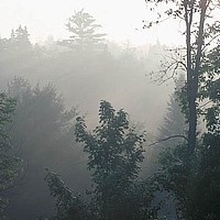
Even though the area has seen drastic changes in the last 150 years, it has been  the conservation efforts by others that have left us of what we enjoy around our immediate area of Coon Lake today.  You can visit many Native or Scientific natural areas just a few miles away. Carlos Avery to the east hosts a very big diverse community of animals and plants.  Boot Lake Scientific and Natural Area features a diversity of habitats. Martin and Island lakes offer a good example a dry mesic oak forest and includes numerous forest plants that are uncommon elsewhere.

With these and other areas we are home to a diverse amount of wildlife to the area.  Just to name a few and some of the more common are the Loon, Double Crested Cormorant, Great Blue Heron, Little Blue Heron, Great Egret, Teal, Canada Goose, Mallards, Pintails, Wood Ducks,  Ring Necked Duck, Bald Eagle, Hawks, Ospreys, Turkey, Pheasants, grouse,  Coots, Sandhill Crane, Yellow Rail, Woodcock, Snipe, Sandpiper, Doves, Owls, Night hawks, Kingfishers, Humming Birds, Woodpeckers, Flycatchers, Larks, Swallows, Jays and Crows, Chickadees, Nuthatchers, Creepers, Wrens, Bluebirds , Thrushes, Catbirds, Starlings, Warblers, Cardinals, Blackbirds,  Sparrows, Meadowlarks, Orioles and Finches. 

Mammals include Opossum. Shrews, Moles, Bats, Rabbits, Hares, Squirrels, Chipmunks,  Woodchuck, Pocket Gophers, Beaver, Mice, Muskrats, Porcupines, Badger, Raccoon, Coyote, Skunk, Foxes, Weasel, Mink and Deer. 

Amphibians and Reptiles include Salamanders, Toads and Frogs including Bullfrog, American Toad, Green Frog, Leopard Frog. Turtles, Lizards, Skinks and Snakes.


There is much more history of the local area  which you can find  by visiting the Anoka County Historical Society.